Saturday, June 29, 2013

COOKTOWN

31st May, 2013

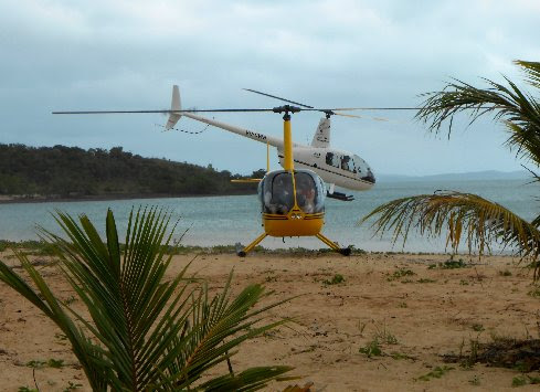
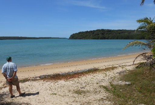
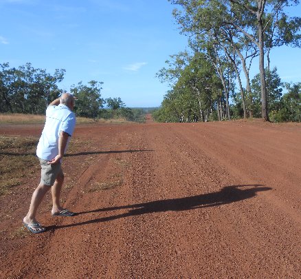
After our dusty trip on the Cape York Peninsula road we are really enjoying being back on the bitumen.  We free camp for the night at a rest area beside the Annan River about 30 kilometres from Cooktown.  In the morning we stop at the viewing area for Black Mountain.
Black Mountain
It’s an eerie sight with huge granite boulders (some larger than shipping containers) forming the mountain.  260 million years ago a mass of molten rock solidified deep below the earth’s surface forming a body of hard granite rock.  An unusual jointing pattern occurred in the granite which led to fracturing.  The fractured granite was gradually exposed as softer surfaces above eroded away.  Water penetrated through the network of fractures and over time rectangular granite blocks were exposed.  The solid granite core of the mountain now lies beneath a layer of jumbled boulders.  There are lots of myths associated with the mountain and stories about people and animals that ventured into the boulders never to be seen again.  It’s not hard to imagine a person or animal falling into the bottomless crevices between the boulders and being unable to get out thus giving rise to the scary stories surrounding the mountain.  We continue on to Cooktown and visit the Information Centre which is set in the botanic gardens and houses two galleries.  There are a number of caravan parks in the Cooktown area but a friendly caravanner has told us that the local council has just opened up an area in town for self contained caravans/motorhomes where one can camp for a maximum of two nights at $5 per night.  We pay our two night fee of $10 at the Information Centre and make our way to the rear of Anzac Park where we join a couple of other caravans that are already set up.  There’s water, a dump point, and a short walk through the park brings us out in the centre of town.  The council has opened this area for camping on a trial basis and we’re pretty sure that the local caravan parks would be vigorously opposed.  We’re just happy that our visit to Cooktown has coincided with the trial camping as it suits our purpose admirably.  After getting set up we hop in Mitzi and take a drive to Grassy Hill Lookout.
View of Cooktown and the Endeavour River
There are interpretive panels at the lookout telling the story of Lieutenant (later Captain) James Cook’s experiences in the area.  It was here on the banks of the river that Cook beached his ship the Endeavour after it had earlier struck a reef offshore from Cape Tribulation.  Cook and his crew spent 48 days repairing the damage and during that time Cook climbed the hill several times in an attempt to try and spot a passage out through the reefs.  Back in town we pay a visit to the James Cook Museum.
St Mary's Convent  - now the James Cook Museum
The museum is housed in a convent which was built in the 1880’s.  It is hard to imagine the hardships faced by the four young nuns that were brought from Ireland to run the all girls St Marys Convent.  Clothed in woollen habits the nuns must have suffered terribly in the hot tropical climate.  The convent operated until World War II when it was evacuated and taken over by the military as a radio operations base.  The convent was never reopened and the building was used for a number of purposes before finally falling into disrepair.  It was going to be demolished but a concerted effort by some local people to save the building saw it restored to its former glory.  It’s a wonderful building and it is worthwhile just wandering through the rooms.  The many galleries dedicated to the history of Cooktown are a bonus.  In one corner of a downstairs room is a spiral staircase.
Spiral Staircase in St Mary's Convent - Just take a look at the height of the ceilings
Although the building has a large staircase leading to the second floor in the entry foyer this spiral staircase was used by the girls boarding/attending school in the convent.  They were not allowed to use the main stairs.  Imagine having to climb up and down this spiral staircase umpteen times a day.  An annex built onto the back of the convent is devoted entirely to James Cook and houses an original cannon and anchor from the Endeavour.
Original cannon and anchor from the Endeavour
Many items were jettisoned from the ship in 1770 in a desperate effort to free it from the reef upon which it had run aground.  Some of these items were retrieved in the early 1970’s and the cannon and anchor were donated to the museum.  During the time spent here Cook and his crew interacted with the local aboriginal tribes and this story is also told from both perspectives – very interesting reading.  An old photo of the tree where the Endeavour was moored to hangs on the wall
Photo of mooring tree used by the Endeavour

and below the photo is the tree trunk itself.
All that is left of the mooring tree
Obviously the tree has long gone from the landing place beside the river and this is all that remains.  Other galleries explore the changing face of Cooktown.  No prizes as to where the town got its name.  The galleries on the first floor, which were former classrooms and the school hall, house objects from pupils and sisters who called the convent home.  There are tales from the 1872 Palmer River gold rush and a display on the rich Chinese heritage of the region.  The Nun’s cells and dormitories are on the upper floor and exhibits detail the strong maritime history and personal stories and objects from local families who endured hardship, loneliness and isolation.  The museum is surrounded by the Sir Joseph Banks Garden in which can be found some of the 170 species Banks identified and named in the region in 1770.  It’s late afternoon by the time we finally arrive back at the van and that night we are treated to the sounds of country and western music emanating from a live show at a pub in the main street.  By midnight the show is over and peace and tranquillity reign once more.

The next day we take a walk through town and down to the river.  There are quite a few old colonial buildings that line the main street and we stop and read the historical information panels along the way.
Charlotte Street - Cooktown
At Cook’s Landing Place a set of stairs has replaced the mooring tree and a statue of a gold miner commemorates the gold rush era.
Statue of gold miner and Cooks Landing Place in background
There are lots of fishing boats and yachts moored in the river and at the wharf some fishermen are trying their luck.  We have a leisurely counter lunch at one of the pubs before making our way back to camp.  In the morning we pack up and take one more walk along the river before heading out.  A statue of James Cook stands in the park and looks out across the river to the open sea.
James Cook memorial - Cooktown
It’s the perfect place for a memorial to this remarkable man!

Thursday, June 27, 2013

EXPLORING THE CAPE

26th May, 2013

Well it was a nice, quiet, sunny day and we were taking time to smell the roses – or in this case the unpolluted tropical air – when the peace and tranquillity was shattered by the sound of a helicopter.  Probably we shouldn’t have been too surprised to see a small yellow chopper heading our way as the sign at the back of our campsite did give us an inkling as to the likelihood of this happening.
Helicopter coming in for a landing on the beach behind our campsite at Seisia
It wasn’t long before it was joined by its mate
Oh Oh  ...  they seem to be multiplying
and a bus load of tourists arrived to take their ten minute joy flight up to ‘the Tip’ and back.  The helicopters are based on Horn Island and use the beach in front of the caravan park as a tourist pick up point  They can only take three passengers at a time so for a couple of hours we were treated to the helicopters’ landings and take offs.  Quite a few of the tourists were not as mobile as their comrades and were not able to make the climb up and over the rocks to ‘the Tip’.   Taking the helicopter ride was the next best option for them to see the most northern point of the Australian mainland in the limited time they had on the bus tour.  Most of the tourists had travelled up the peninsula in the 4WD bus and were returning via the ship that makes a run to Seisia from Cairns once a week with supplies.  The tour bus then returns to Cairns with a new load of tourists that the ship has brought.  It’s not the cheapest way to see the Cape but does save people from having to make the bone jarring road trip two times.  There are a few tracks to explore on the Cape so we head off in Mitzi to have a look at a couple of historical sites.  Near the airport is Jackey Jackey Creek – named after the aboriginal that accompanied explorer Edmund Kennedy on his ill fated journey up the Cape.  At the airport is a cairn which recognises his effort in making it to Port Albany near Somerset in order to summon help for the men that were left behind along the way.
A track near the airport takes us to the wreck of a World War II Beaufort Bomber.
Wreckage of Beaufort Bomber in bushland near the airport
There was a large military presence on the Cape during World War II and the rainforest surrounding the airport is littered with rusting 44 gallon drums.  The buildings have long since gone but hidden in the undergrowth are concrete floors and foundations.  Along another track we find the wreckage of a DC3 that crashed enroute to New Guinea in 1945.
DC3 Wreckage
A memorial plaque has been erected at the site in remembrance of those on board who died.
After spending the day checking out different tracks, we head back to the campground and watch the sunset over the water.  In the morning it is time to pack up and head back down the Cape.  We take one last look at Torres Strait and hit the road.  By mid morning we have made it back to the ferry at the Jardine River and another hour later come across the road crew near Fruit Bat Falls.  We’d like to say that the road had improved since we had last travelled on that section but sadly it was in a worse state with the corrugations seemingly to have grown in size.  Thankfully the ditch beside the road was in better shape and for most of that forty kilometre stretch Mitzi and the Van became very adept with the intricacies of evading culverts and the odd fence post.  Late that afternoon we pulled into Moreton Telegraph Station and set up camp.
Entry gate to Moreton Telegraph Station
The station is beside the Wenlock River and a new bridge has been built next to the old river access
Bridge across the Wenlock River at Moreton Telegraph Station
making the river easier to cross during the ‘wet’.  Major flooding can still be a problem though when cyclones and rain depressions occur and a few years back this makeshift raft was hastily assembled to transport people and vehicles across the swollen river.
Makeshift raft at Moreton Telegraph Station
Wok reckons that with a few new 44 gallon drums to replace the old rusted out ones, the raft would be a ‘goer’ again in no time at all.  The Telegraph Station was established in 1887 as part of the telegraph line that ran from Cairns to Thursday Island.  There were only two wires, one up and one down, sending morse code via repeater stations along the way.  The line was upgraded to radio during World War II and six wires were used to transmit the signals.  In 1962 communications were upgraded to microwave repeater towers.  The old telegraph line ceased to exist but the  occasional old telegraph pole can still be seen along the way.  The following morning we continue our journey south and take the turnoff at Batavia Downs Station and head west to Weipa.  This seventy kilometre stretch of dirt road which joins the Peninsula Development Road with the Weipa Road was excellent.  It had recently been graded and we actually managed to travel most of its distance at 90 kilometres per hour.  It was wonderful!  By lunchtime we were at Weipa and checked into the caravan park for the night.  It was pretty hard not to miss the signs that Weipa is a mining town.  This is the site for the world’s largest bauxite mine and is operated by Rio Tinto.  Large freighters are moored at the docks and a continuous stream of trucks bring the ore to the conveyor belts.  Fishing is obviously a very popular pastime with a fishing fleet and lots of recreational boats in the bay.  There is also an interesting centre at Evans Landing which gives an insight into the local aboriginal culture and mining history of Weipa.  In the morning we head south once more and can’t help but notice that there is lots more traffic on the road compared to over a week ago.  Parts of the road that were good on the way up have started to deteriorate and corrugations are starting to form.  We see two separate roll overs that have occurred the day before.  A reminder to take it slow around blind corners where the corrugations are the worst.  At Archer River Roadhouse we pull in to top up with diesel and have lunch.  While we chow down a convoy of about thirty four wheel drives pull in.  It is a Variety Club rally headed for the Cape. 
Variety Club rally cars at Archer River Roadhouse
Thank goodness we had stopped for lunch otherwise we would have met them on the road and would have had to contend with all the accompanying dust clouds.  On our last night headed down the track we free camped beside the Coen river just to the north of the town.  Wok tried to catch some yabbies but we didn’t have the right gear.  We will have to do something about that!  By mid afternoon the following day we had reached the bitumen at Laura and our odyssey to the Cape was over.  The last hundred kilometres of dirt road had really fallen to pieces over the time we had been in the north. 
One last look at the road to 'the Tip'
It seems that we have timed our trip to the Cape at just the right time    ahead of the first influx of four wheel drivers of the season.  We have had a great experience and will definitely remember our drive to ‘the Tip’.

Sunday, June 23, 2013

THURSDAY ISLAND

25th May, 2013

It’s an early start for us this morning.  At 8am the ferry to Thursday Island departs from Seisia and as we are locking up the van the ferry putters past on its way to the jetty.
Thursday Island Ferry
On the way to the jetty we walk through what once was a small park and stumble across a memorial which is partly hidden in the undergrowth.
It’s a sad but poignant reminder of the dangers that lie beneath the calm waters.  At 8 o’clock on the dot the ferry casts off and we get a glimpse of our van and campsite as we head off on the hour long voyage to Thursday Island.
Our campsite at Seisia
On the way we pass by Possession Island where in 1770 Captain Cook proclaimed the territory he had charted for Great Britain.  It doesn’t seem any time at all before Thursday Island looms up on the horizon.
Thursday Island
The island has a population of around 3,500 and covers 3.5 square kilometres.  The islanders have a rich cultural heritage – very different to the aboriginal culture.  Once on shore ‘TI time’ takes over and a more relaxed lifestyle is the norm.  Perhaps the turtle sculpture that greets us on arrival gives an indication to slow down and smell the roses.
Wok likes this turtle
We hop on a small bus and take a tour around the island to get the ‘lay of the land’.  Close to the port is the main shopping area.  A supermarket, hardware store, service station, shops and hotels spread out along one main street.  Schools, library, churches, a hospital, sporting facilities, cultural centre and many government services are available for the islanders.  Fifty eight metres above sea level is Green Hill.  The fort that stands here was built in 1891-1893 and is one of the most intact nineteenth century forts remaining in Australia.

Wok stands on the fortifications at Green Hill
The underground magazines house a museum of military and local history.  The guns that stand guard are of World War II vintage but did not see any military action.
Guns stand guard over Torres Strait on Thursday Island
They were fired for practise drills and one local story is that of a school mistress on an outlying island who made her way to the fort and gave the Commander a dressing down after an errant shell landed in the quadrangle of her school.  Luckily it was a ‘dummy’ shell and did not contain explosive. 
What is it that men find so attractive about big guns ???
From the walls of the fort we get a wonderful view of the town
Thursday Island main town - Horn Island in the background
and surrounding islands.  It is a clear day and we can just make out the mainland to the south.  Across a small channel we can see Horn Island and at 53 square kilometres is one of the largest islands of the Torres Strait.  It has a population of about 900 who live at Wasaga in the island’s northwest.  Horn Island played a major role in World War II as a frontline base for allied troops.  The wartime airstrip now serves as a link for the people of Torres Strait to the rest of Australia.

We hop off the bus at the cemetery and take a stroll.  Pearl shell brought riches and tragedy to those in the industry and many young men from Wakayama Prefecture in Japan came to Thursday Island to make their fortunes diving for shell.  Sadly many lost their lives and were laid to rest in the island cemetery.  A Japanese memorial has been erected at the cemetery
Japanese Memorial in cemetery on Thursday Island
and not far from the memorial are the many graves of the Japanese pearl divers.
Japanese pearl diver's graves
Some of the Japanese made Thursday Island their home and their descendants still live here.  Today’s islanders have a strong Christian faith and a person’s life is treasured.  When an islander passes away the grave is marked with a simple white cross and covered with flowers.
The grave stays like this until a headstone can be procured from the mainland.  The grave is covered with black plastic or a tarp and then another ceremony takes place when the headstone is unveiled.
As we walk among the graves we are surprised by the extravagant headstones and memorials.  Not only are the person’s name, birth, death and next of kin on the headstone but also their life story and accomplishments.
Each one seems to be more luxurious than the last and there is a never ending array of symbols and images.  Truly amazing!

After our island tour we take a walk through town and as it is lunchtime stop at the most northern pub in Australia (the Torres Hotel) for a meal and some liquid refreshments.
Torres Hotel - most northern hotel in Australia - Thursday Island
At 2pm we head back down to the jetty to catch the ferry back to the mainland.  It’s not a good idea to be late as the next ferry doesn’t depart until the following morning – meaning a sleepover on the Island.  Maybe that isn’t such a bad idea.  It’s certainly very laid back and relaxing    one could easily while away a day or two    maybe even a year or more  ……..

Friday, June 21, 2013

TO THE 'TIP'

24th May, 2013

We’re off to explore the Northern Peninsula Area of Cape York today.  We leave the van safely tucked away at the caravan park and set off, stopping in at the ‘Croc Tent’ which is a privately run Information Centre/Gift Shop on the way to the ‘Tip’.
The Croc Tent - Cape York Peninsula
The obvious reason as to why this is called the ‘Croc Tent’ resides in an enclosure beside the entrance.
Croc Tent mascot
The croc may be stuffed but is a reminder as to the dangers of venturing into the waters around here.  We receive a map of the road in this area and advice on track conditions.  The guy says that although they have had recent rains all the tracks are accessible with a 4WD.  We will have some water courses and creeks to cross but he assures us that Mitzi is high enough to stay dry inside.  So off we go!  The road soon becomes little more than a winding track through the rainforest
Cape York track
and thankfully we only meet a couple of oncoming vehicles.  Both vehicles then do a bit of jiggling/backing up/take to the bush action to allow access for one vehicle to get by.  There are lots of potholes and washouts to negotiate but finally we make it to Somerset on the eastern side of the peninsula.
Somerset Bay
Somerset was run by pioneer Frank Lascelles Jardine in the 1800’s and was a grazing and copra plantation.  The Jardine River bears his name.  We stop and have a picnic lunch here before taking a walk along the beach.  At the northern end of the beach is a small graveyard and there are some Japanese graves – testimony to the dangers of diving for pearls.  Pearling was a lucrative business in these parts in the late 1800’s and early 1900’s.
Japanese pearl divers graves at Somerset
Near the graveyard is a memorial to explorer Edmund Kennedy.
In 1848 Edmund Kennedy set out from Rockingham Bay with a party of 12 men to explore Cape York.  The party struggled north to Weymouth Bay where he left behind eight men and at Shelburne Bay three more men were left behind.  Kennedy continued north with a young aboriginal man ‘Jacky Jacky’ and had almost reached his destination when he was killed in an encounter with a local aboriginal tribe.  Jacky Jacky completed the journey alone and raised the alarm.  Only two survivors of the expedition were found alive at Weymouth Bay – the remaining men were never found.

We hop back in Mitzi and head along the track to the most northern part of mainland Australia     the ‘TIP’.  The track is just as bad as the Somerset track with a few deep creek crossings thrown in.
Creek crossings on the way to the 'Tip'
Finally we come to a small clearing beside the waters of Torres Strait where two vehicles are parked.  Looks like this is as far as Mitzi can go.  From here we have to walk.  There is a track over the rocky hill in front of us but luckily we have managed to coincide our visit with low tide and we can walk along the tidal flats for a few hundred metres before being stopped by the water.  It has been an interesting walk along the sand/mud with lots of soldier crabs scuttling around and a piece of oyster encrusted pearl farming equipment makes for a great photo op.
Abandoned pearl farming equipment at Cape York
We climb up onto the rocks and make our way over the headland.  Looking back we can see the coastal flats and bay.
View of Torres Strait at Cape York
At last our goal is in sight – the northern most tip of the Australian mainland.
Wok walks down to the 'Tip'
The Great Dividing Range rises at the Tip and follows the east coast all the way south.  It’s quite steep climbing down the rocks to the strategically placed sign.  We are of course not at the most northern tip of Australia.  That honour goes to an island further north that is ridiculously close to Papua New Guinea and possessed by Australia.  There are a lot of islands sprinkled across Torres Strait and even from this spot we can see quite a few.  We can however cross one more thing off our ‘bucket list’ – to drive up Cape York Peninsula and stand on the northern tip of the Australian mainland     Woohoo!

Thursday, June 20, 2013

CAPE YORK PENINSULA

21st May, 2013

We’ve spent the last ten days relaxing and drying out from the soaking we received at Innisfail.  We have also been trying to make our mind up about whether to attempt the drive up Cape York Peninsula to the very northern most part of mainland Australia.  It is approx. 950 kilometres from where we are camped and 750 of those kilometres are untarred.  4WD is recommended as road conditions can vary from ‘This isn’t too bad’ to ‘OMG – get us out of here!’  Most people (if they do not have an off road camper trailer) leave their caravan stored at one of the parks in this area and just take their 4WD vehicle and tent it or stay in dongas at the roadhouses or stations along the way.  As luck would have it, friends of our nephew Wayne (Trevor and Jacqui) have just returned from a trip to Lockhart River which is an aboriginal community about two thirds the way up Cape York.  Their son is employed there and they have made the trip in their 4WD and off road caravan – very similar to our set up.  They check into the caravan park we are in and provide us with some good information about the condition of the road as far as the turnoff to Lockhart River.  It appears that the road is in reasonable condition (as of two days ago) with road crews working at different spots.  We make the decision to ‘give it a go’ and the following morning we are on the road headed for the Cape.  At lunchtime we stop at James Earl Lookout and get a glimpse of the road ahead as it disappears into the distance.
Looking north from James Earl Lookout
That night we free camp at a rest area (slightly overgrown) at Morehead River and are joined by two caravanners heading south.  They have been visiting relatives at Weipa and report that the road is pretty good to the turnoff.  We join them for a pot luck barbecue dinner and fireside chat before turning in for the night.  On the road north the next day we occasionally pass vehicles heading south.  We usually slow down to crawl mode to let them through.  Apart from blind corners and crests the oncoming vehicle can usually be detected by the billowing cloud of dust accompanying them.  Stopping completely and pulling as far to the left of the carriageway as we can when a road train comes through is a really good idea.
Road Train coming through
Apart from all the stones/rocks that they launch at you it is impossible to see if there is any other vehicle behind them in the dust cloud.
Can't see any cars coming  ...  Can't see the road either!
We reach the Weipa turnoff and within a few kilometres the road has dwindled to one lane.
Everyone drives down the centre as it is pretty soft on the shoulders
The track itself is quite good and apart from slowing down for all the dips we make good time.  Since leaving the bitumen yesterday we have trundled through numerous dips.  Some are nice and smooth, some have a concrete or bitumen base, some have gravel and some have water running through them.  Dips are nasty things.  They lure you in with the promise of an easy crossing and then WHAM!  Suddenly you are faced with the ‘potholes from hell’.   Our advice … SLOW DOWN … and come out the other side in one piece.  Apart from the occasional vehicle and roadhouse every few hundred kilometres there are no signs of civilisation.  The cattle stations that occupy Cape York have huge land holdings and the farm houses and outbuildings are sometimes many kilometres away from the road.  We pull up at the entrance to Bramwell Station
Entrance to Bramwell Station
and decide to camp the night.  The station is about six kilometres off the road so we definitely will not hear any road noise.  Mind you anyone travelling that road at night needs their head read!  We will however hear lots of farm noise.  The camp area is next to some cattle pens where a herd of calves has been separated from their mothers.
Our camp spot at Bramwell Station
There’s lots of mooing going on and we are wondering whether road noise might be preferable.  As darkness came, the mooing died down, and all was peaceful in the camp.  Ahhh – the sounds of the night      an occasional bird call      an occasional moo      the rumble of the generator***    Farm life!   Just magic!

In the morning we are up at the crack of dawn.  Well we are on a farm and there are chores to be done!  It is probably our earliest start for ages but there doesn’t appear to be many vehicles on the road. 
Looks like we will have the road to ourselves for a while ...
The track is surprisingly good and near Fruit Bat Falls we finally run into the road crew that has been working on this section of road.  We now realise what a wonderful job they have been doing because as soon as we pass them the road deteriorates.  The carriageway is wide but there are corrugations from one side to the other making it virtually impossible to do anything but crawl up and down the ridges.  Wok finally resorts to driving in the gutter beside the road to try and get a smooth track.  For the next forty kilometres we travel at snail pace until finally we arrive at the Jardine River.  Once we cross the river we will be in the Northern Peninsula Area and not far from our goal.  We do however have to pay the ferryman and you can forget about not paying him until you get to the other side.  If you don’t pay you don’t go      as simple as that.  We had been warned about how expensive the ferry was so we didn’t bat an eyelid when the ferryman asked for $145 to take us across.  If we hadn’t had the caravan it would have been $100.  Mercifully our return journey is included in the price.  This would have to be the most expensive ferry crossing we have ever encountered      working on money per distance travelled.   As you can see from the following photo the river isn’t all that wide.  We estimated that if there were two ferries you could put them end to end and drive across them from one side of the river to the other. 
Crossing the Jardine River
For the adventurous 4WD enthusiasts there is a river crossing about twenty kilometres east of the ferry.  This crossing is part of the Old Telegraph Track and many four wheel drivers test themselves out along this track.  Many four wheel drivers also get stuck in the river crossings along the track and need assistance to get going again.  Trevor and Jacqui can attest to the problems of crossing rivers on the Cape.  On their way out from Lockhart River they got bogged in the Pascoe River (which they had successfully crossed on the way in) and finally managed to get out when a helpful truckie turned up.  Jacqui said it was quite frightening with the water lapping up the door over the sill and Trevor up to his waist in water trying to get some rocks under the wheels.  And don’t forget – we are in croc country and salties just love hanging around river crossings waiting for a snack.  Well we were now on the northern side of the river and there were only forty kilometres left to go.  We would like to say that they were the best forty kilometres we had travelled but unfortunately they were not.  We did manage to travel at a speed slightly above snail pace but corrugations, washouts and potholes slowed our progress considerably.  It was with a sigh of great relief that we finally reached the start of the bitumen near the aboriginal community of Injinoo and not long after that we were driving through Bamaga which is the main town of the area and a further eight kilometres on we arrived at Seisia overlooking Torres Strait.  Seisia wharf is a hive of activity with barges arriving from Cairns and outlying islands and ferries arriving and departing to Thursday Island.  We check into Seisia Holiday Park not far from the wharf
Wharf at Seisia
and get a nice spot backing onto the beach.
Our site at Seisia - complete with 'don't even think about going for a swim' croc sign
We liked the signs on the amenity block.  It doesn’t take a genius to work out which sign is for the men and which is for the ladies.
 
It was time for happy hour and the campers opposite us had an unexpected guest.
Hmmm  ...  wonder what beverage is on offer here?
Over the next few days we discovered this wasn’t a rare occurrence.  There were a number of horses that roamed the whole area (not just the caravan park) and we always saw them munching away on the grass verges beside the road when we went for drives.  That evening we watched the sun go down over the water of Torres Strait     a great way to end the day!